Posts

Victorian 4wd track closures

I just got back from a weekend of camping near Walhalla which is a really beautify area if you ever get the chance to visit.  Anyway, I had heard a number of the people coming were planning to go four-wheel driving and I thought it might be a chance to find out what my new (to me) Freelander could do, so I set about making some maps of the area. The maps just re-use a set of styles I had previously developed to create some topographic maps of rural areas that had worked pretty well for me in the past, with almost all the data downloaded from data.vic.gov.au .  Everything was going well until realised I should check if there were any track closures in the area and after a quick google search I found Parks Victoria - Seasonal road closures , and it turns out there were quite a few, both seasonal and management vehicle only tracks.  In the past I had tried to use tracks from the Vicmap Transport - Road Network dataset that on arriving at the track, discovered they had cle...
Communicating in Data Science

​Recently I wrote a chapter on 'data' in a transport engineering book (coming out soon) and one particular aspect I found rather hard was to avoid being repetitive. Over and over I kept coming back to, "the reason for this is to better communicate x, y or z".  Communication is a critical and often overlook part of any analysis, data science or otherwise, so it is worth spending some time thinking about how to do it well.  T his article doesn't draw a lot of conclusions, it is more arguing for a need for a framework, however Roger does allude to one that I know he likes to use and that's the 'reproducible research' concept... Specialization and Communication in Data Science From the Simply Stats blog by Rafa Irizarry, Roger Peng, and Jeff Leek.  

Introductions

Image
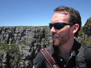
Hi, I'm Will and I'm a map-aholic. I have been interest in maps since I started hiking in scouts, I'm one of those strange people that finds beauty in contour lines (because we all know the topographic map is the king of all maps).  But seriously, it is amazing how much information you can put on a map in an elegant way. I was first introduced GIS while doing a placement in local government in 2003, I was fascinated, even just plotting drainage pipes on a map, but it was the briefest of introductions and it was years till I came back to it.  After uni I ended up in road and transport research where I got my teeth into data analysis and was able to dabble in GIS again. 12 years on I'm still working in transport research and after commencing a data science course I'm doing more data analytics, management and GIS than ever.  The thing that has helped my skills along the most is being able to use open source software products means that I can also do GIS, map mak...